| Section: The basic unit of the system, a square piece of land one mile by one mile containing 640 acres. | |
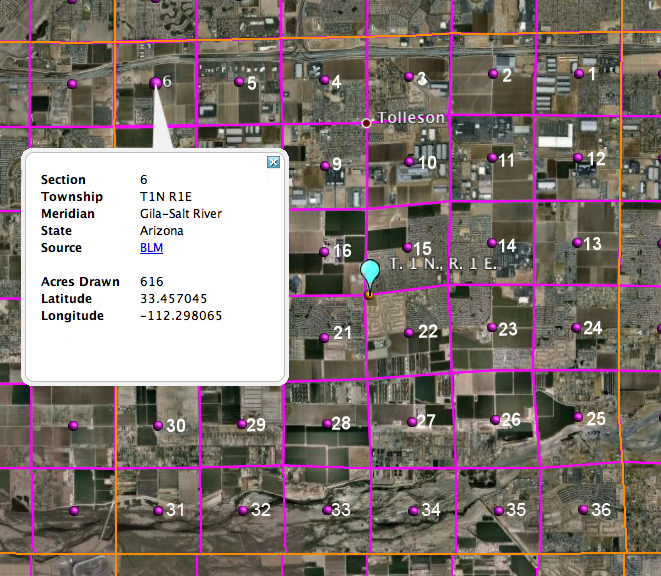
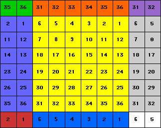
| Township: 36 sections arranged in a 6 by 6 square, measuring 6 miles by 6 miles. Sections are numbered beginning with the northeast-most section (#1), proceeding west to 6, then south along the west edge of the township and to the east (#36 is in the SE corner). | |
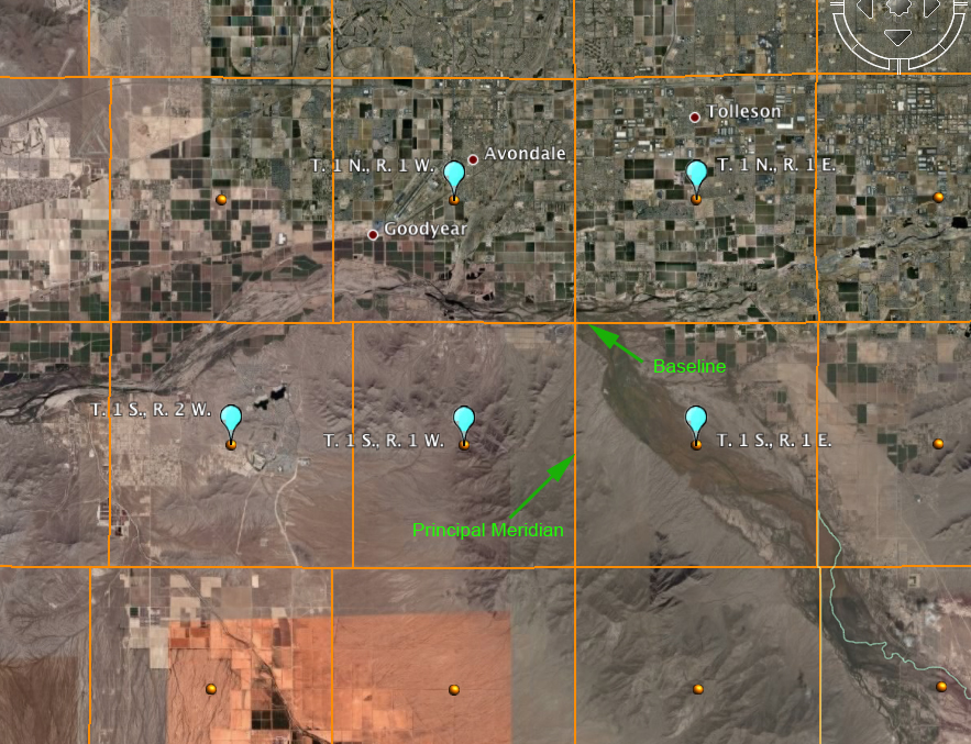
| Range: Assigned to a township by measuring east or west of a Principal Meridian | |
| Range Lines: The north to south lines which mark township boundaries. | |
| Township Lines: The east to west lines which mark township boundaries. | |
| Principal Meridian: The reference or beginning point for measuring east or west ranges. Map of meridians & base lines from the BLM web server | |
| Base line: Reference or beginning point for measuring north or south townships. |

Within each section, the land is referred to as half and quarter sections. A one-sixteenth division is called a quarter of a quarter, as in the NW1/4 of the NW1/4. The descriptions are read from the smallest division to the largest.
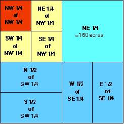
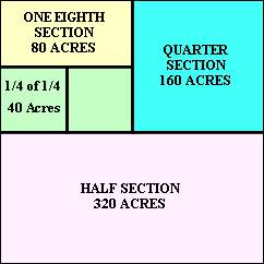
ONE SECTION =
640 ACRES
Sample descriptions are in the ( )s.
| A full section contains 640 Acres. | |
| A half section (S1/2) contains 320 Acres. | |
| A quarter section (NE1/4) contains 160 Acres. | |
| An eighth section (N1/2 of NW1/4) contains 80 Acres. | |
| A sixteen section (SW1/4 of NW1/4) contains 40 Acres. |
Locating a Place Using USPLS Land Descriptions
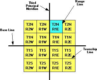
As mentioned above, to locate a feature of interest, you should locate the largest part using the township and range supplied in the description first. In this case T.2N., R.1E. Remember the T.2N. refers to Township 2 North (of the Baseline), and the R.1E. refers to Range 1 East (of the Principal Meridian).
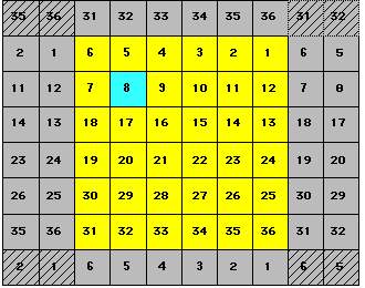
After you have located the correct township, you will next need to find the correct section within that township. Using the example given above the land description states Section 8, T.2N., R.1E. So you would look in the township found in step 1 for section 8.
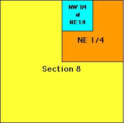
Step 3
Now that you have located the correct section you need to find where in
this section your land feature is located. Our example says NW1/4
of NE1/4 of Section 8, T.2N., R.1E. So you would first look in
section 8 for the NE1/4 of the section (shown as orange in the chart to
the left.) After locating the NE1/4 of the section your last step will
be to find the NW1/4 of that NE1/4 (shown in aqua in the chart to the
left.) The well is generally located at or near the center of the
last unit given.
Let's look at an example using Google EarthTM in Arizona
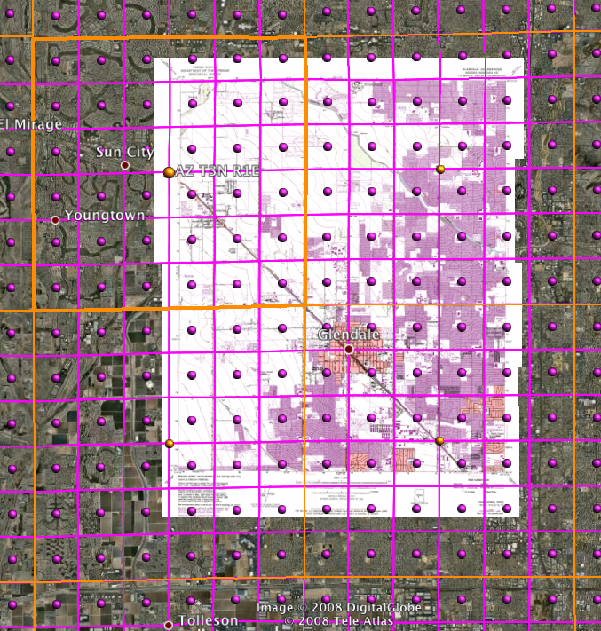
Now, let's look at the Glendale Quadrangle with the township overlays displayed. The orange borders are the outlines of the townships and the purple borders are the outlines for the individual sections. Are there any complete townships on the Glendale Quadrangle? Look at it before you read the answer...No, there aren't any complete townships. How many incomplete townships are there? Count them before you read the answer...There are four incomplete townships on the Glendale map.
When you need to do this on the Folsom, NM quadrangle, you will need to survey (carefully look over) the map and determine if there is a complete township on the map. Given the size of a township relative to a 1:24,000 map (scale of Folsom, NM quad is the same as that for Glendale below), it is unlikely that there would be more than one complete congressional township on the map area. Once you've done that, you need to count how many incomplete townships there are. Be careful that you do not count the sections.
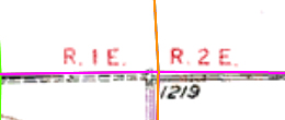
Township T. 3 N., R. 1 E. is highlighed with a thicker orange outline (upper left township). Any object of interest (school, house, business, etc) inside this box would have a USPLS designation of T. 3 N., R. 1 E. The City of Glendale would be in T. 2 N., R. 2 E. To see the divisions between the townships, we have to zoom in to the edges of the map area and look for the red text. The image below this large map shows an enlargement of such a division along the top edge of the map (where the orange township boundary intersects the map edge). See below where the orange line separates R. 1 E. from R. 2 E.
